© Geoff Radcliffe 2011
Walking with a GPS Device
This is a guide to creating routes for your GPS device using freely available software such as Google Earth and GPSBabel together with purchased software such as Garmin MapSource. I have included some interesting walks with photos and tracks you can download to your GPS device.
See Creating a Route Using Google Earth.
If you have a paper map and don’t know the grid to use or your GPS software doesn’t include the required grid, I have also described how to create a User Defined Grid to match a paper map.
There is a section on creating a schedule for a route together with a downloadable calculator.
My Top Tips
- Before setting off on a walk, mark your position with a waypoint. This will enable you to navigate back to the start of the walk should you need to.
- Just before setting off on a walk, clear the track log. The track log will then only show the track from your start point.
- Set the GPS device to use Magnetic North, so that you can use your compass with the bearings it gives.
- Carry spare batteries.
- The direction bearing given by the GPS device to the next waypoint is more accurate the further away the waypoint is. The bearing given for a waypoint only a few metres away may be wildly inaccurate. This is because the GPS device may only be able to identify your exact location to within five metres or so.
- Buy a compass which has a Romer scale for measuring distances on a map and taking accurate grid references.
- Ensure that your GPS device has been set to use the same grid and datum as the paper map you are using.
My Background
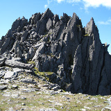
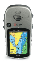
Whenever I go walking in the hills I always take my GPS device; I’d be lost without it! This was not always the case as I thought that they were of limited use and that my navigation skills using a map and a compass weren’t too bad. At first, I considered a basic model, but, after some research, I wanted a model that I could load maps on to via a memory card and that had a built in altimeter. I chose the Garmin Etrex Vista Hcx which had these features and also allowed me to load up to 50 routes and 1000 waypoints. It also has good battery life and is waterproof.
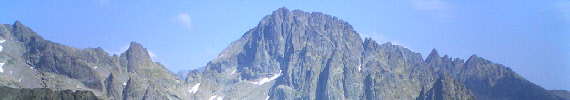
I now use my GPS device in conjunction with various software packages to locate places, plan routes, and keep a record of all my walks. Recently, I used it to help me navigate the peaks on the Welsh 3000s.
Whenever I go abroad, I like to plan walking routes using large scale maps of the area I am visiting. However MapSource includes a large range of datums and grids that can be used together with a very useful User Defined Grid.
However, a GPS device with all of its features is no substitute for a map and compass. Rather than using the in-built compass of the GPS device, I prefer to use my compass to follow a bearing.
Garmin Etrex Vista Hcx
I like this hand-held device as it has good battery life, I can add maps, I can add lots of waypoints and routes and it has an altimeter.
If you have any comments about this web site, you can email me here.